
Home > Apps > Maps & Navigation > 2GIS: Offline map & navigation

| App Name | 2GIS: Offline map & navigation |
| Developer | 2GIS |
| Category | Maps & Navigation |
| Size | 180.4 MB |
| Latest Version | 6.44.1.559.3 |
| Available on |


Navigate the world with ease using 2GIS, your comprehensive offline map and GPS navigation solution. Whether you're driving, walking, or taking public transit, 2GIS offers detailed maps, live traffic updates, and more to ensure you never lose your way—even without an internet connection.
With 2GIS, you can:
- Quickly locate addresses, businesses, phone numbers, operating hours, and services.
- Plan your route by car, bus, subway, or on foot with precise navigation.
- Find building entrances and nearby parking spots effortlessly.
Our accurate maps pinpoint districts, buildings, streets, bus stops, subway stations, gas stations, sports grounds, and other points of interest.
2GIS's GPS navigation takes into account real-time traffic conditions, road signs, speed cameras, toll roads, and unpaved routes. It offers inter-city and multi-point route planning, and there's a free app compatible with Android Auto.
Stay connected with loved ones using the live friends' location feature. Track your kids or friends on the map for their safety, send fun stickers, and check their battery levels. Control who you share your location with and manage your privacy settings easily.
Stay informed about road events such as accidents, blocked streets, and speed cameras, all reported directly on the map by users.
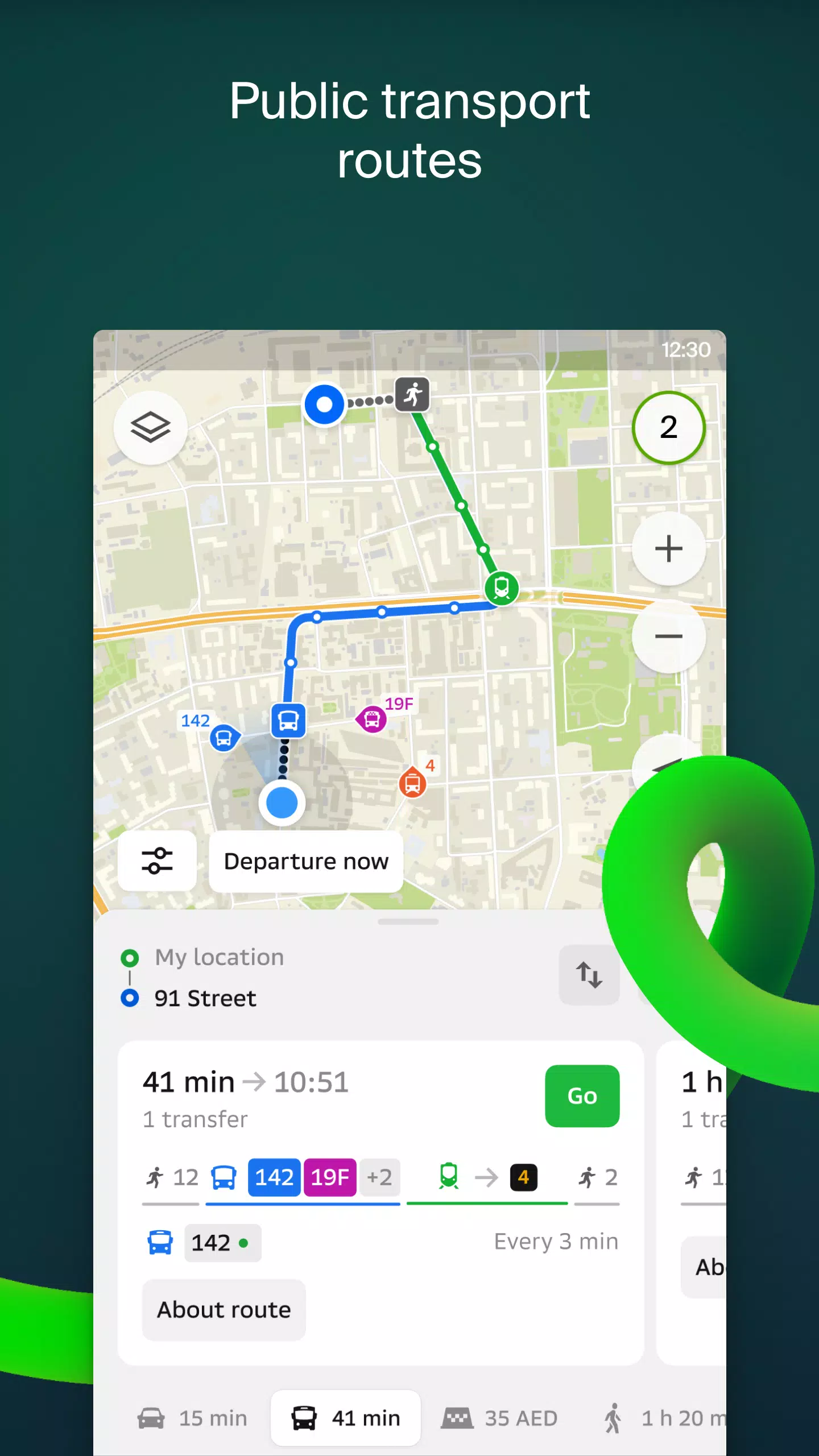
Public transport schedules and real-time routes are at your fingertips with 2GIS, ensuring you catch your bus or train on time.
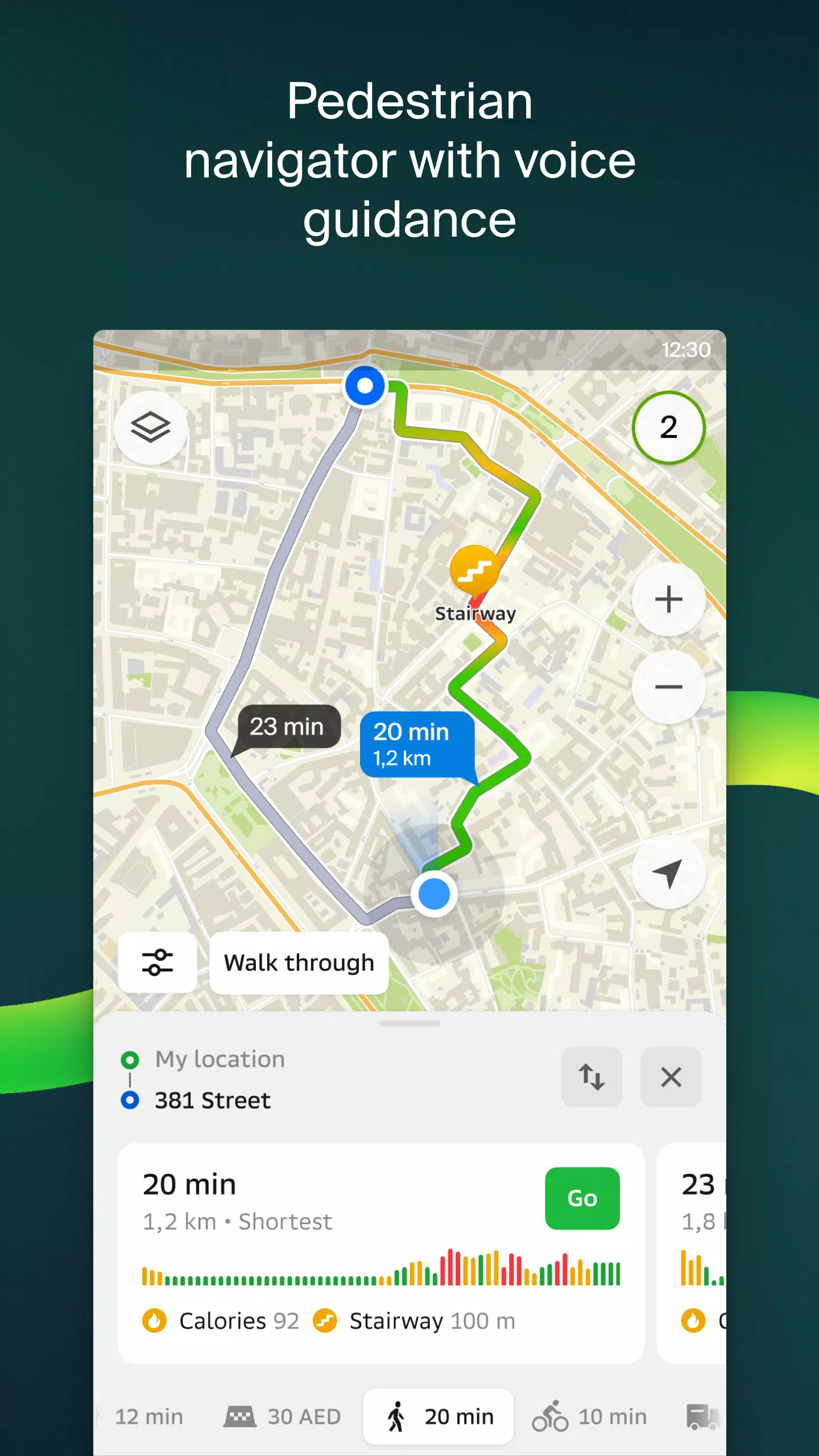
For pedestrians, 2GIS provides walking routes with background navigation and voice guidance, making it easy to explore on foot.
Truck drivers can benefit from specialized navigation that considers the unique characteristics of their vehicles and cargo.
The detailed directory in 2GIS includes addresses, entrances, postal codes, phone numbers, operating hours, social media links, and websites. Users can add photos and reviews to help others make informed decisions.
Explore new destinations with our travel guide, which highlights main attractions and places with Wi-Fi on the map.
Enhance your navigation experience with the 2GIS Notifications companion app for smartwatches running on Wear OS. This handy tool offers route guidance for walking, biking, or public transport, complete with map views, maneuver hints, and vibration alerts for turns or bus stops. It automatically starts when you begin navigation on your phone and is compatible with Wear OS 3.0 and later versions.
Available maps cover numerous cities in the UAE, Russia, Belarus, Kazakhstan, Uzbekistan, Azerbaijan, and Kyrgyzstan, including Dubai, Moscow, Minsk, Almaty, and many more.
For support, reach out to us at [email protected].
-
 Sonic Racing: CrossWorlds Characters and Tracks Revealed for Upcoming Closed Network Test
-
 Marvel Rivals Season 1 Release Date Revealed
-
 Honkai: Star Rail Update Unveils Penacony Conclusion
-
 Announcing Path of Exile 2: Guide to Sisters of Garukhan Expansion
-
 Ubisoft Cancels Assassin's Creed Shadows Early Access
-
 Best Model Kits for Adults in 2025: Ultimate Guide