
Home > Apps > Travel & Local > MAPinr - KML/KMZ/OFFLINE/GIS

| App Name | MAPinr - KML/KMZ/OFFLINE/GIS |
| Developer | Xylem Technologies |
| Category | Travel & Local |
| Size | 76.3 MB |
| Latest Version | 4.1.2 |
| Available on |


Discover the power of seamless KML/KMZ/GPX management with MAPinr, your go-to app for GIS, measuring tools, GPS logging, WMS, and offline maps. At MAPinr, we're dedicated to enhancing your mapping experience while keeping up with the fast-paced Android ecosystem. Despite the challenges non-profit projects face due to rapid Android version updates, we remain committed to our mission of delivering a secure, privacy-focused, and affordable mapping solution.
We understand that the latest Android versions might not be supported on all devices. That's why we offer downloads for older versions (below Android 14) directly from our website, ensuring that everyone can continue to enjoy MAPinr's features.
Whether you're looking to manage your points of interest or wanting to pin your pictures on a map, MAPinr has you covered. This simple, ad-free Android app is designed for both professional use and leisure activities like hiking, cycling, running, and skiing.
We value your feedback and are eager to hear your ideas on how to improve MAPinr. Please share your thoughts and suggestions via email at [email protected]. We appreciate your patience and understanding, as our limited resources mean we can't implement every suggestion immediately. However, your input is invaluable to us.
MAPinr offers a comprehensive set of features:
- Ad-Free Experience: Enjoy uninterrupted use without any ads.
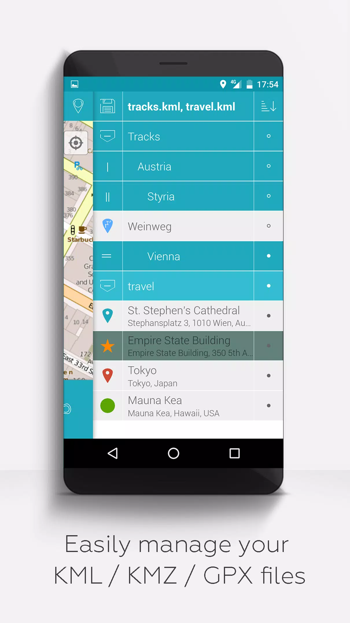
- Organized File Management: Use a hierarchical folder structure to manage multiple KML/KMZ/GPX files effortlessly.
- Comprehensive File Operations: Create, load, edit, save, import, export, and share KML/KMZ files.
- Waypoint, Line/Track, and Polygon Management: Create, edit, save, import, export, and share these elements.
- Photomap Creation: Add pictures to your waypoints to create engaging photomaps.
- Versatile Map Display: View waypoints, lines/tracks, and polygons on various maps including Maps, Satellite, Hybrid, OpenStreetMap, Opentopomap, and Opencyclemap.
- Coordinate Sharing: Easily share the coordinates of your waypoints.
- Customizable Visuals: Individually colorize waypoints, lines/tracks, and polygons for personalized mapping.
- Interoperability: Open exported KML/KMZ files in other apps for further use.
- Advanced Search: Search by name, address, and coordinates for quick navigation.
- Location Sharing: Let your friends know where you are with our location-sharing feature.
- Simultaneous File Viewing: Display multiple KML/KMZ/GPX files at the same time.
- File Merging: Combine KML/KMZ files for streamlined management.
- Cloud Integration: Seamlessly integrate with cloud services for data access and backup.
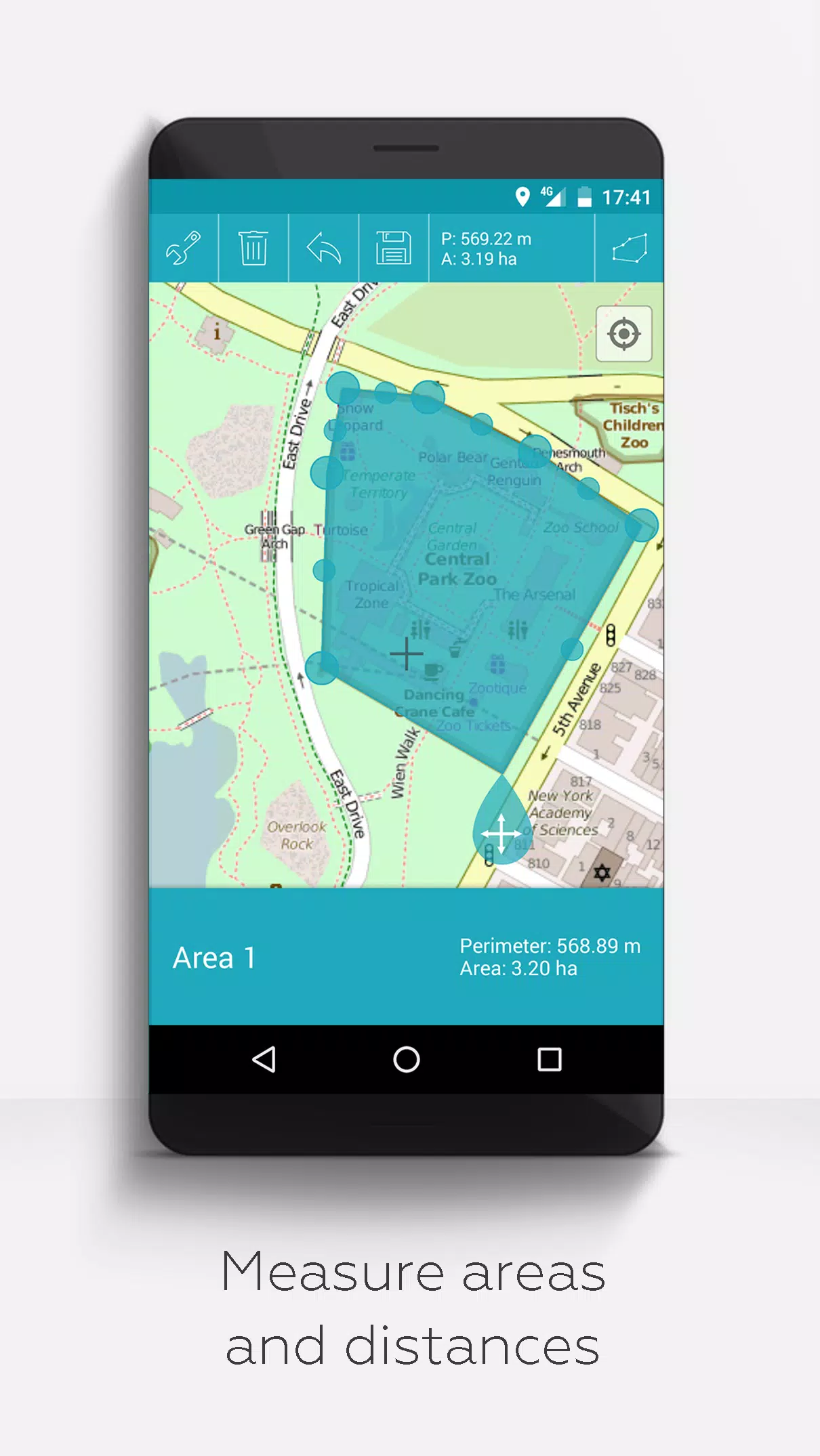
- Measurement Tools: Measure distances and areas directly on your map.
- Multilingual Support: Currently available in English, Spanish, Lithuanian, and Polish.
Extend your MAPinr experience with these additional features, available for free with donations or by showing support on LinkedIn (activate in Settings):
- Offline Maps: Download OpenStreetMap tiles for free to use without an internet connection.
- GPX Viewer: Display GPX files effortlessly.
- Web Map Service (WMS): View arbitrary map data, including Opendata from www.data.gov.
- Custom Metadata: Create and use custom metadata for enhanced data management.
- Custom Icons: Upload and use custom icons to personalize your maps.
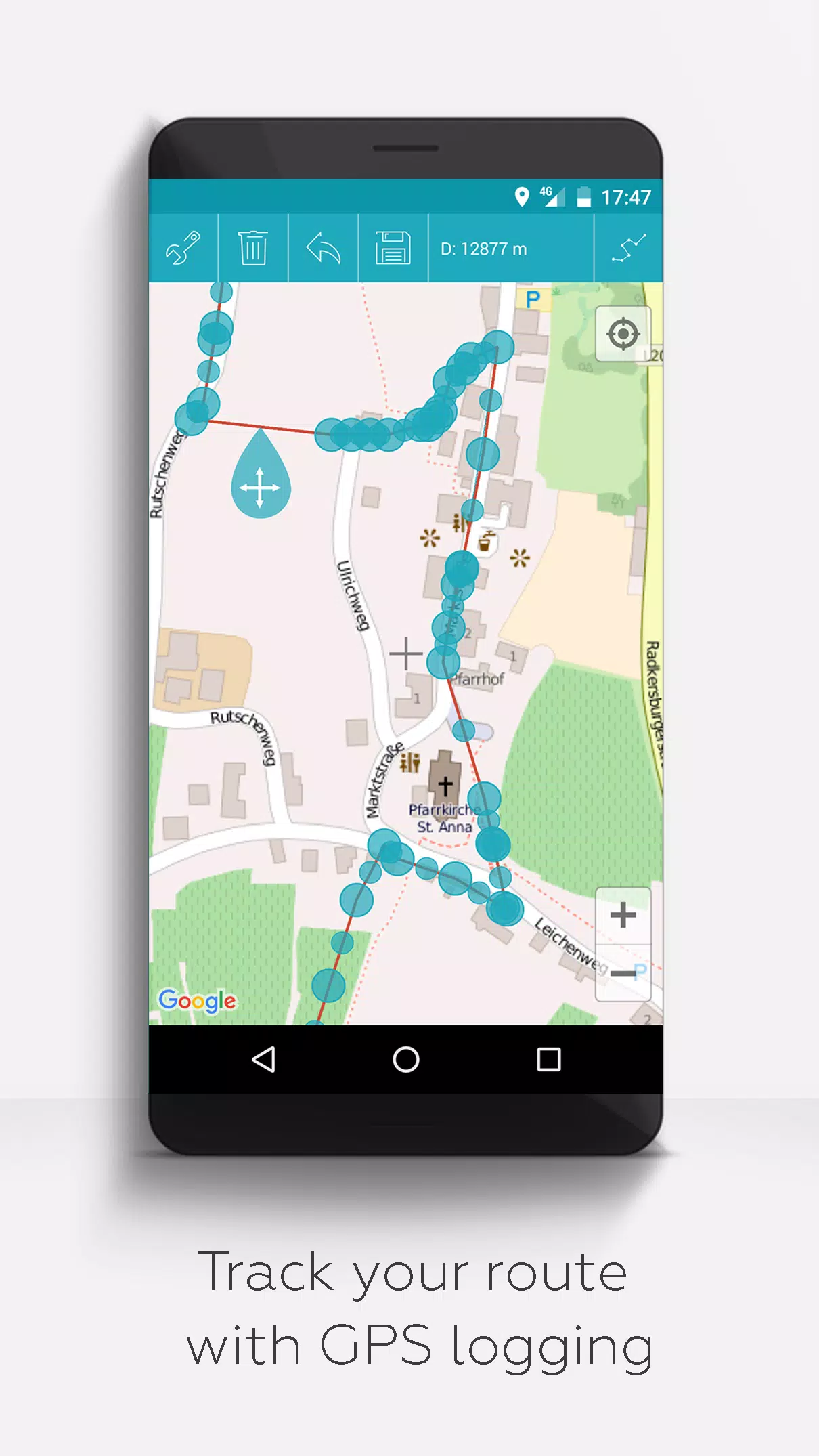
- GPS Track Recording: Record your GPS tracks for future reference and analysis.
Unlike other apps, MAPinr prioritizes your privacy and does not collect or sell your personal data. Donations are a voluntary way to support our non-profit efforts and help us continue to provide this valuable service.
-
 Sonic Racing: CrossWorlds Characters and Tracks Revealed for Upcoming Closed Network Test
-
 Marvel Rivals Season 1 Release Date Revealed
-
 Honkai: Star Rail Update Unveils Penacony Conclusion
-
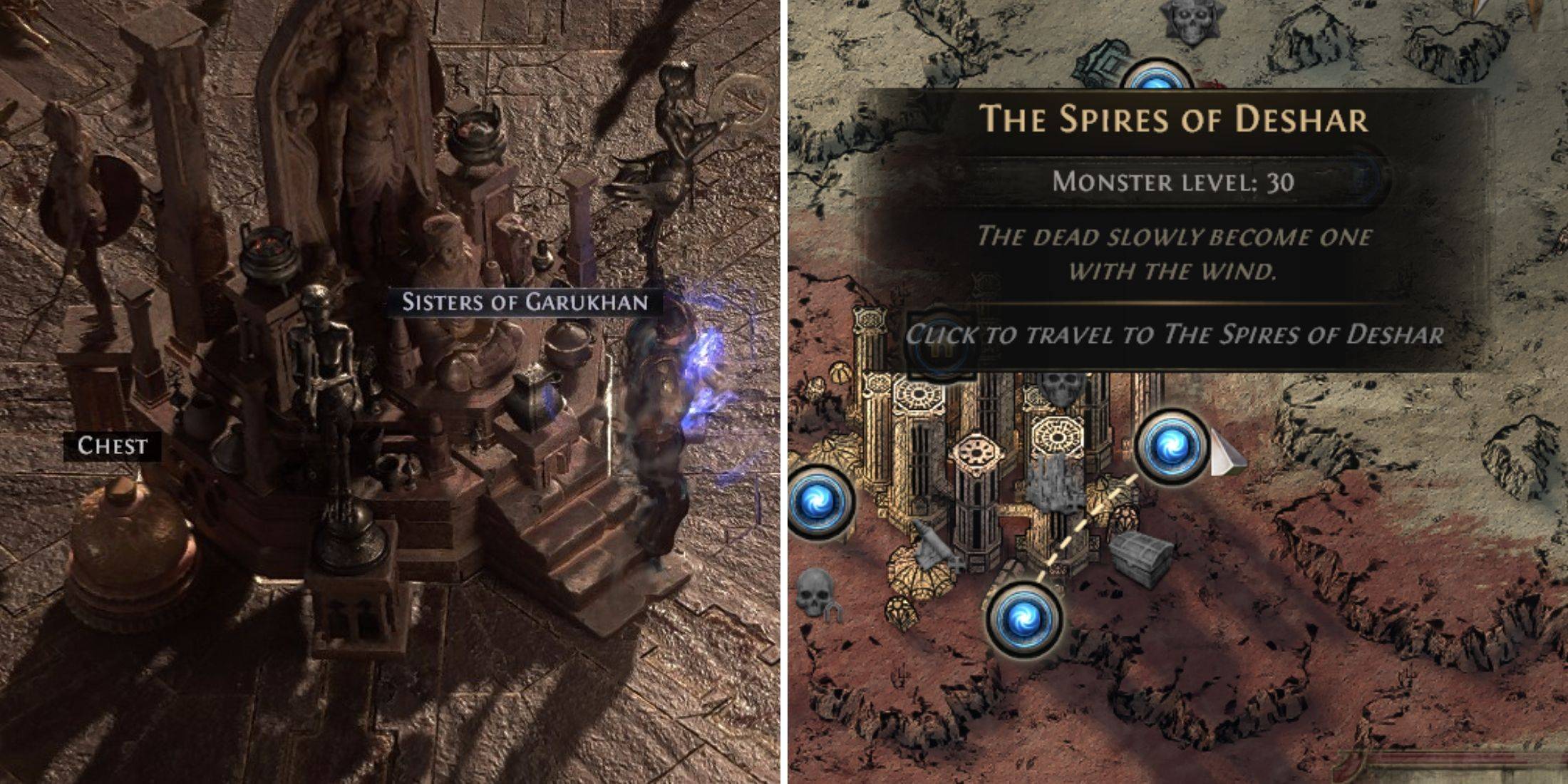 Announcing Path of Exile 2: Guide to Sisters of Garukhan Expansion
-
 Ubisoft Cancels Assassin's Creed Shadows Early Access
-
 Best Model Kits for Adults in 2025: Ultimate Guide