
Home > Apps > Maps & Navigation > Mapy.cz: maps & navigation

Mapy.cz: maps & navigation
Jan 15,2026
| App Name | Mapy.cz: maps & navigation |
| Developer | Seznam.cz, a.s. |
| Category | Maps & Navigation |
| Size | 169.7 MB |
| Latest Version | 9.55.1 |
| Available on |
4.7


Your Ultimate Guide to Outdoor Adventures
Plan hiking, cycling, skiing, and alpine excursions by car or public transportation
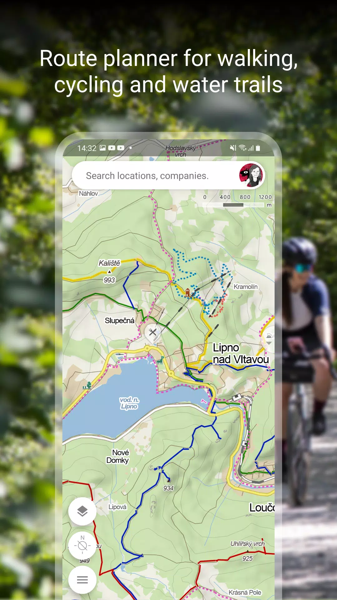
PLAN YOUR PERFECT ROUTE
- Discover scenic hiking and cycling trails
- Find cross-country skiing and alpine ski routes
- Use our "travel tips" feature for curated journeys through area highlights
- View detailed elevation profiles for all routes
- Get precise 5-day weather forecasts including temperature, wind, and precipitation worldwide
EXPLORE GLOBAL TOURIST MAPS
- Comprehensive trail networks for hiking and biking
- Detailed classification of roads, mixed paths, and pedestrian routes
- Worldwide hillshade maps with via ferrata difficulty ratings
- Educational trails and protected areas information
- Accessible routes for wheelchair users
MULTIPLE MAP VIEW OPTIONS
- Global aerial imagery
- Czech street panoramas with 3D viewing
- Winter-specific maps with current ski trail conditions
- Real-time Czech traffic maps showing closures and parking zones
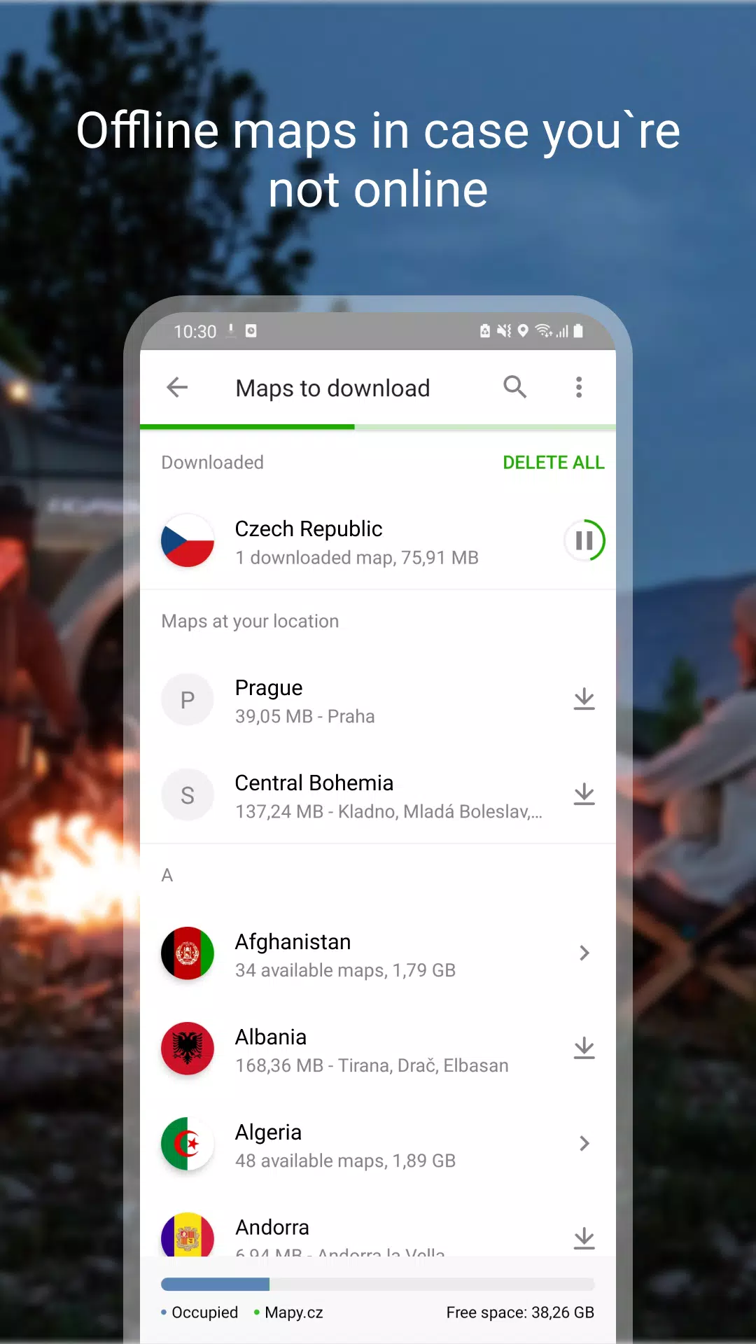
OFFLINE MAPS FEATURES
- Download complete global hiking/cycling maps for offline use
- Voice-guided offline navigation for all travel modes
- Offline Czech winter maps with ski resort details
- Region-specific downloads for targeted exploration
- Full search and route planning without internet connection
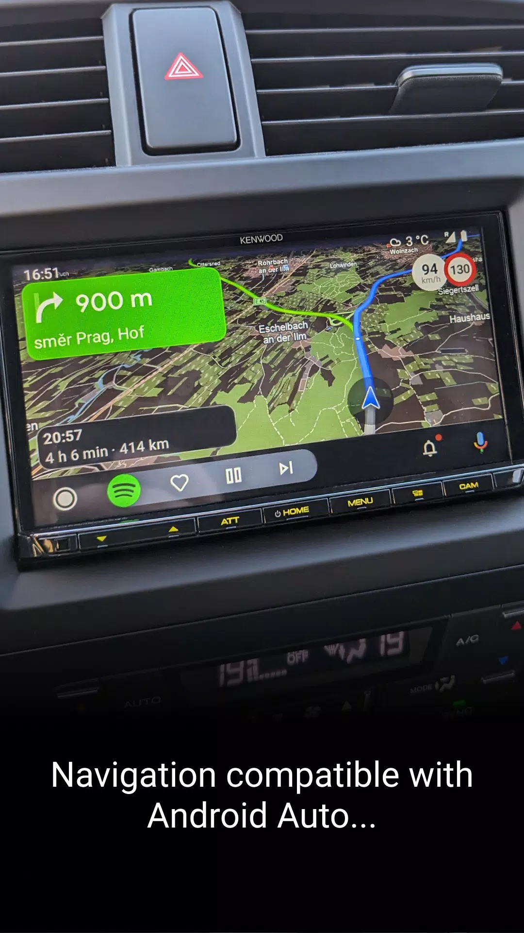
COMPREHENSIVE NAVIGATION TOOLS
- Lane guidance and roundabout assistance
- Toll road avoidance options
- Dark mode for nighttime use
- Real-time location sharing via multiple platforms
- Android Auto and Apple CarPlay integration
- Speed camera alerts and traffic notifications for Czech roads
- Crowdsourced driver reports on road conditions
- Accident-prone area warnings and winter maintenance status
PERSONALIZED TRIP PLANNING
- Organize saved locations, routes, and photos
- Activity tracking for various outdoor pursuits
- GPX file import/export functionality
- Cross-device synchronization of planned routes
CURATED LOCAL RECOMMENDATIONS
- Recent visitor photos of destinations
- Authentic reviews of dining and services
- Filter options by ratings and top-rated spots
IMPORTANT TIPS & NOTES:
- Internet required for initial map downloads
- Enable location services for full functionality
- Background location permission needed for sharing features
- Access troubleshooting via in-app support form
- Extended GPS use may impact battery performance
- Join our community at www.facebook.com/Mapy.cz/ to share feedback and stay updated
Post Comments
Top Download
Top News
-
 Sonic Racing: CrossWorlds Characters and Tracks Revealed for Upcoming Closed Network Test
-
 Marvel Rivals Season 1 Release Date Revealed
-
 Honkai: Star Rail Update Unveils Penacony Conclusion
-
 Announcing Path of Exile 2: Guide to Sisters of Garukhan Expansion
-
 Ubisoft Cancels Assassin's Creed Shadows Early Access
-
 Best Model Kits for Adults in 2025: Ultimate Guide